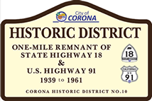
Local Historic Districts
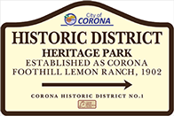
Corona Heritage Park and Museum is located on the headquarters of the former Corona Foothill Lemon Company. The Corona Foothill Lemon Company was the largest regional citrus ranch in the early twentieth century. The former Corona Foothill Lemon Company home ranch headquarters is now located at 510 West Foothill Parkway (formerly near the corner of Lemon Street [and later Chase Drive] and Taylor Streets) celebrates Corona’s rich citrus heritage. It is located on one parcel of land containing 5 contiguous acres.
Heritage Park is located at the site of the Foothill Ranch, Corona’s last citrus packinghouse complex. The site includes the company store (now the museum), a packinghouse, the original residence of ranch founder, H. E. Hampton, various other outbuildings, century old trees, exotic specimens of plants and trees and a small functioning lemon grove.
The Foothill Ranch complex was established in 1911 by H. E. Hampton. He built his home and his citrus production company on this site. Three buildings have known construction dates: 1913, 1927 and 1937. The trees predate the buildings. There have been few architectural alterations to the buildings.
Heritage Park is not only the site of the former Foothill Ranch company comples, but was planned as a repository for historic buildings being forced from their original locations elsewhere in the city. In 1998 the Corona Historic Preservation disassembled the historic 1904 Hotel Del Rey, located at the corner of Sixth Street and Victoria Avenue, and stored beams, joists, studs, siding, windows and other architectural elements in SEA containers on site for future reassembly as a part of the Heritage Park.
The purpose of Corona Heritage Park is “to promote and enhance an appreciation for the origins and development of the city including its early industries with a special consideration for citrus.” In Corona, at the height of production in 1935, 2,406 acres of lemon groves were harvested, filling1,138 railroad cars for delivery to market. Corona became part of history as “The Lemon Capital of the World.”
The Call Ranch house was subsequently relocated from its original site near the corner of California Avenue and Ontario Avenue to the southwest corner of the property.
The Corona Historic Preservation Society has placed an historic site marker (Number 10) outside the Foothill Parkway entrance driveway to memorialize the site.
Extracted from Corona Register of Historic Resources Staff Report for Historic Landmark: HD-001, Heritage Park.
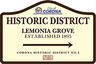
The Historic District known as Lemonia Grove is located on three and one-half acres of land located at 2750 Rimpau Avenue
Oscar Thieme, a German businessman, established the estate known as Lemonia Grove in 1895 after visiting Corona on business in 1892. Thieme’s goal was to become a wealthy lemon rancher whose mansion and palatial gardens would impress the local citrus industry elite. On the original 26-acre estate, located at the northwest corner of Lester Street (now the extension of Rimpau Street) and Lemon Street (now Chase Drive) that was previously used as a sheep pasture, he planted it out in Lisbon lemons, with a perimeter of orange trees. He subsequently purchased acreage south of Lemon Street and an additional 66 acres in the Orange Heights area. He later built a storage building on the premises along with the historic carriage house. He reserved two acres for his residence and private gardens.
In his efforts to create a unique atmosphere for his home he attempted to develop the drab and arid ranch to mimic the rich beauty the countryside of his homeland in Germany by bringing costly and rare plant specimens from the places he visited all over the world. He planted the area around his home with a wide variety of lush specimen trees. ornamental shrubs, colorful flowering vines and multitudes of flowers. While plans for his mansion were being drawn, Thieme and his wife lived in the upper floors of the carriage house, or in a home on Magnolia Avenue, depending on the stories told. Local architect, Leo Kroonen Sr., completed the architectural plans for the main house, but the Thiemes returned to Germany prior to World War I, and it was never constructed.
Some of his plantings included
Brazilian Pepper trees Monkey Puzzle tree
Jacaranda Kaffir Plum trees
Bottle trees Many varieties of Plums
Eucalyptus Macadamia Nut tree
Many other rare trees and shrubs Rubber tree
Many of these trees can now be found in local nurseries but at that time they were very rare and unique. What is unique about the site is that all these plant materials are assembled in one place. The garden is said to have been manicured with great Prussian precision and efficiency. Gravel and brick walkways, benches and fish ponds were to be found throughout the site. There was a gazebo constructed out of tree branches, similar to the “stick” furniture that is popular today. It was not inexpensive to maintain the garden.
Carriage House:
Local architect Leo Kroonen Sr. designed and constructed a beautiful Victorian carriage house entirely of redwood soon after Thieme purchased the land. It was not uncommon for barns, sheds and carriage houses to be built first, with homes to follow. This one has lots of “gingerbread” trim to make it unique. The upper, floor is finished for living rooms, probably for a butler or chauffer. It has a steep gabled roof, thick shingles on the roof, fish scale shingles on the siding, windows and looks very much the same today as it did 100 years ago. The lower floor was dirt and the carriage could be placed inside. Horses would be put in the shed attached to the north wall. The gardens and carriage house remain today, largely unaltered.
Grand Entrance:
The grand entrance to the property was off Lemon Street (Chase Drive) through an ornate wooden gate structure, along a path flanked with palms. The ornate wooden gate structure remained in use from the late 1880s to 1946 when it had deteriorated to such a point that it could not be repaired. It was replaced with a masonry post constructed of native rock from Railroad Canyon. This entry marker was very modest in comparison to the original structure. The gate was removed when the property was subdivided into the current surrounding development.
Lemon Storage Building/Packing House:
About five or six years after Thieme arrived, a lemon storage building was constructed to hold the products of the surrounding groves. This storage building was later converted into a spacious home, with the addition of a kitchen and wrap-around porch. Thieme owned a large lemon curing house and packinghouse along the Santa Fe Railroad right-of-way. It was considered one of the largest and best equipped packing houses in Southern California.
Mansion/Thieme Home:
The main structure was to be Mr. Thieme’s home. It was designed by local master architect Leo Kroonen, but was never constructed. The wherabouts of the plans are unknown. One can only imagine the beauty of a structure that would please Mr. Thieme.
The Corona Historic Preservation Society has placed an historic site marker (Number 16) outside the Rimpau entrance gate to memorialize the site.
Extracted from Corona Register of Historic Resources Staff Report for Historic Landmark: HD-002, Lemonia Grove and Corona Public Library resources
Images Chase gate, Carriage house, Home, Aerial views (6)


<
>
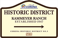
The Historic District known as Kammeyer Ranch is located on five acres of land located at 2837 South Kellogg Avenue.
The Gilbert family built the two-story Vernacular wood frame house with steeply pitched multi-gabled roof, clapboard siding, and double-hung windows on this site in 1892. Citrus ranchers, the Gilbert family’s groves surrounded their home. Few exterior alterations have been made to the house, which is in excellent condition and has been occupied by the Kammeyer family for six generations. In 1999, the Whitmore house at 2542 Gilbert Avenue was relocated to Kammeyer Ranch as a casualty to housing developments in South Corona, to preserve it and prevent its demolition. This 1895 “Butler Style” house has largely been restored by the Kammeyers. The site also contains an operational citrus grove, scattered outbuildings, a unique above-ground galvanized tank, and a modern business office built in the style of the Kammeyer Ranch/Gilbert house, gardens and ponds.
Both the Kammeyer/Gilbert house and garage and the Whitmore house are excellent examples of typical houses found on agricultural land at the turn of the nineteenth century in Corona. The restoration and maintenance efforts of the Kammeyer family have preserved these structural treasures, as well as the historic setting in which they are located.
Extracted from Corona Register of Historic Resources Staff Report for Historic Landmark: HD-003, Kammeyer Ranch.
.jpg?crc=3961712523)
.jpg?crc=4114698479)
.jpg?crc=68393171)
.jpg?crc=278118346)
.jpg?crc=3891131206)
<
>
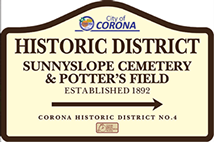
The Historic District known as Sunnyslope Cemetery is located on twenty-seven acres of land at 1125 South Rimpau Avenue. A small section in the eastern portion of the cemetery site was reserved to bury paupers from 1892-1930 and is known as Potter’s Field.
Sunnyslope Cemetery was built on the outskirts of town surrounded by orange groves. It was promoted as “alive with laborers during the day, quiet and peaceful at night. Just the place one would want to spend an eternity.” As the only cemetery in Corona, many of the city’s founding families are buried within this Historic District.
In 1892 a group of Corona citizens met and organized the South Riverside Cemetery Association, which then incorporated under state Laws. It opened as a non-profit local cemetery called Sunnyslope Cemetery, or more recently, Corona Cemetery and has remained so. It is the only cemetery in Corona. From 1930-1936, a number of improvements were made to the site including planting of trees, and other landscaping, adding gravel driveways, and erecting a Soldier’s Memorial monument, originally honoring veterans of the Civil War and later modified to include subsequent war veterans.
The grounds, graves, headstones and memorials at Sunnyslope Cemetery are visual reminders of the people who founded, shaped, guided and shared our city’s history.The city of Corona has recognized this site as a landmark property as an historic district. It was the collective efforts of the city’s early denizens that have produced the city we know today.
Over the years the cemetery has played host to a “Cemetery Walk” or “Cemetery Stroll” near Halloween, in which sponsoring organizations, the Corona Historic Preservation Society, the local Geneology Society, and others have identified four or five persons interred at Sunnyslope Cemetery, based on an annual theme. Some themes have been: City Founders, Women of influence in early Corona, early Corona Firefighters, veterans of the Civil War, etc. Local residents perform as actors and portray the former resident(s) an share the highlights of his/her life.
The Corona Historic Preservation Society has placed an historic site marker (Number 18) near the Cemetery Office to memorialize the site.
Extracted from Corona Register of Historic Resources Staff Report for Historic Landmark: HD-004, Sunnyslope Cemetery and Potter’s Field, and Corona Public Library resources.
Images Gate grounds, Obelisk and family plots
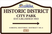
The Historic District known as City Park is located on twenty acres of land at 930 East Sixth Street.
The city purchased the land for City Park on April 30, 1912, from Herbert Praed and Charles and Mary Kekewich, who were unsuccessful in getting lemons to grow there. City Park was the first park built in the city. The contract with P. M. Rasmussen for park development was signed on November 27, 1912, in the amount of $3,600.00.
The contract listed every tree, plant and flower to be planted on the site. The number of required plants was 1,676. Irrigation was added in 1925. Local architect, Leo Kroonen Sr. designed a “City Plunge” swimming pool complex that was built in 1925, and demolished in 1967, after giving thousands of hours of joy to Corona residents. A Founders Plaque was erected on the site in 1936. It was listed as, California Historic Landmark No. 738 CORONA FOUNDERS MONUMENT. Corona’s 20-30 club, comprised of men between the ages of twenty and thirty-nine, had placed the first bronze plaque which was stolen and recently replaced by the City of Corona. Much of the original landscaping as well as the Founder’s Monument, remains today.
City Park opened in 1913 and was the heart of the city for many years. Historically, it served as a gathering place for civic events, family reunions, church picnics, games and sports, and romantic walks. In 2013, in addition to celebrating its own centennial, it hosted the activities surrounding the centennial of the first Corona Road Race held in 1913. For over forty years, the Plunge provided relief during the hot summer months, and the park’s downtown location ensured its accessibility to all residents. The enormous Moreton Bay fig tree that used to shadow the front of the plunge still remains.
City Park is defined by its open space, picnic tables, shelters, landscaping, trees and shade, recreational opportunities, and its relaxing beauty. These qualities are timeless, offering a bond between the families of yesteryear and today. The park has changed over the years as many old-timers remember the magnificent cactus garden, the children’s wading pools (the smaller of the two still remains as a planter), the long picnic tables under the tile-roofed shelters, the merry-go-round, see-saw and old metal slide in the playground area, the softball diamond and other amenities. Only a few pictures remain of the large cannon, left over from World War I, that sat near the front of the park until World War II, when it was melted down for the war effort. The air compressor, from the Sunkist plant, that powered the whistle, heard throughout the community for many decades, now sits near the front of the park.
Extracted from Corona Register of Historic Resources Staff Report for Historic
Landmark: HD-005, City Park.
Images:
Cannon, Plunge, bk 1 Pg 95, bk 2 pg 41, Wading Pool, bk 2 pg 39, Shelters, bk 1 pg 115
Cactus garden bk 2 pg 42 Aerial view

.jpg?crc=276766400)
.jpg?crc=4017444959)
.jpg?crc=3905123739)


<
>
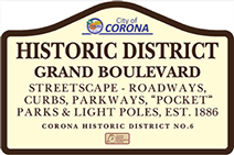
The Historic District is within the existing right-of-way for Grand Boulevard and is one of the city’s original streets set out within the map of Lands of South Riverside Land & Water Company, recorded on February 12, 1887, in the records of San Bernardino County; prior to the establishment of Riverside County.
The map was surveyed and drawn in 1886 by Hiram Clay Kellogg, an Anaheim engineer of note. Anecdotally it is recorded that he also laid out the roadway in three days after a competing engineer indicated that it could not be completed in several weeks.
The roadway and original improvements were established in 1887 with the original circular configuration remaining intact to this day. The planting within the wide parkways contain many large mature trees, planted during the early part of the 1900s.
The unique circular roadway was a prominent design feature used as an automobile race course for internationally acclaimed road races in 1913, 1914 and 1916 to attract prospective citizens, businessmen and investors. For the 1913 race some 100,000 spectators were drawn to Corona. Racing legends competed here as well. One of the palm trees planted in the nineteenth century still bears the marks from a collision with one of the legendary racecars.
Grand Boulevard is a unique circular roadway, one-mile in diameter and nearly three miles in circumference, which has given rise to the longstanding moniker “The Circle City”, which makes Corona distinctive from any other city. The city’s only “Boulevard”, it contains wide parkways, large mature trees, and historic street lamps fronting the stately homes of the city founders and early city leaders.
The Boulevard continues to provide the downtown area with the small town ambiance that many Corona citizens remember from the past and continue to cherish. Many homes fronting this street are themselves either on the local Historic Register or are eligible for listing.
The Grand Boulevard Historic District is listed on both the Federal and State Registers of Historic Places.
Extracted from Corona Register of Historic Resources Staff Report for Historic Landmark: HD-006, Grand Boulevard Streetscape.
Images:
Circular roadway image(s)
Streetscape on southeast Grand


<
>
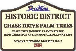
This Historic District consists of the rows of palm trees along both the north and south sides of that portion of East Chase Drive from East Foothill Parkway to Garretson Avenue. These trees were planted when Chase Drive was known as Lemon Street.
The portion of East Chase Drive near Foothill Parkway is lined with Mexican fan palms averaging over 60 feet in height transitioning to California fan palms, averaging 40 feet in height, as you travel west for approximately a mile. The height and visibility of the palms have enabled them to become an identifying feature of a once active agricultural area.
It is estimated that these trees were planted in the 1930s to mark streets and edges of various citrus groves. Through the years, the City has recognized the importance of this visual resource and has strived to protect the location and integrity of the trees. In the 1990s when development was going to cause the loss of some of these trees, they were relocated to the parkways of Grand Boulevard north of the route of the 91 Freeway.
The height and visibility of the palm rows on East Chase Drive have created an outstanding visual resource that can be seen from almost any location within central Corona. The excellent visibility is due to the topography of the city sloping gently from the eastern slopes of the Santa Ana Mountains of the Cleveland National Forest to the Temescal Creek and Santa Ana River valleys. The palm rows are a distinguishing feature that marks the original street patterns and agricultural heritage of the city.
Extracted from Corona Register of Historic Resources Staff Report for Historic Landmark: HD-007, East Chase Drive Palm Trees.
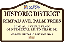
This Historic District consists of the rows of palm trees along both the east and west sides of that portion of Rimpau Avenue from Old Temescal Road to Chase Drive. These trees were planted in the 1920s and 1930s when Chase Drive was known as Lemon Street.
This portion of Rimpau Avenue is lined with alternating Mexican fan palms averaging over 60 feet in height and California fan palms, averaging 40 feet in height. Near the intersection with Chase Drive, Canary Island Date Palms are also included. The height and visibility of the palms create an impressive streetscape visually marking the
roadway from throughout the city. The palms are part of the citywide street-tree plan created in the 1930s by Ralph D. Cornell, a prominent City Planner and Landscape Architect.
It is estimated that these trees were planted in the 1930s to mark streets and edges of various citrus groves. Through the years, the City has recognized the importance of this visual resource and has strived to protect the location and integrity of the palm rows along Rimpau Avenue. With the length of the streetscape and alternating heights of the trees, HD-008 is one of the most impressive intact examples of this type of planting.
The height and visibility of the palm rows on Rimpau Avenue have created an outstanding visual resource that can be seen from almost any location within central Corona. The excellent visibility is due to the topography of the city sloping gently from the eastern slopes of the Santa Ana Mountains of the Cleveland National Forest to the Temescal Creek and Santa Ana River valleys. The palm rows are a distinguishing feature that
marks the original street patterns and agricultural heritage of the city.
These trees provide a reminder from the past that our residents cherish.
Extracted from Corona Register of Historic Resources Staff Report for Historic Landmark:
HD-008, Rimpau Avenue Palm Trees.

.jpg?crc=4003245403)

<
>
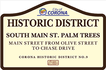
This Historic District consists of the rows of palm trees along both the east and west sides of that portion of Main Street from Olive Street to Chase Drive. These trees were planted when Chase Drive was known as Lemon Street.
This portion of South Main Street is lined with a variety of palms, including Mexican fan palms, California fan palms, Canary Island palms and Queen palms. These trees average 40-60 feet in height. Interspersed between the palms are Shamel ash, California peppers, Jacarandas, Carrotwood, and Crepe Myrtles. The height and visibility of the palms, coupled with the other mature trees create an impressive unique streetscape. Main Street is part of the citywide street-tree plans created in the 1930s by Ralph D. Cornell, a prominent City Planner and Landscape Architect.
It is estimated that these trees were planted in the 1930s within the wide parkways of the city’s main thoroughfare. Through the years, the City has recognized the importance of this visual resource and has strived to protect the location and integrity of the palm rows and adjacent mature trees along South Main Street. With the length of the streetscape and mix of tree species in a wide parkway, HD-009 is one of the most impressive intact examples of this type of planting marking a main roadway.
The height, species mix and visibility of the palm rows on South Main Street have created an outstanding visual resource that can be seen from almost any location within central Corona. The excellent visibility is due to the topography of the city sloping gently from the eastern slopes of the Santa Ana Mountains of the Cleveland National Forest to the Temescal Creek and Santa Ana River valleys. The palm rows are a distinguishing feature that marks the original street patterns of the city.
Extracted from Corona Register of Historic Resources Staff Report for Historic Landmark: HD-009, Main Street Palm Trees.
-crop-u57711.jpg?crc=3808468724)
.jpg?crc=4089282260)
.jpg?crc=3855480097)
.jpg?crc=3892007247)
.jpg?crc=3910416415)
.jpg?crc=155707680)
<
>
1. Heritage Park
2. Lemonia Grove
3. Kammeyer Ranch
4. Sunnyslope Cemetery
5. City Park
6. Grand Blvd.
7. Chase Drive Palm Trees
8. Rimpau Avenue Palms
9. Main Street Palms
10. SR-18, US 91
